The Sikasso Property

(While much of the following information is extracted from “NI 43-101 Technical Report on the Sikasso Property, Republic of Mali” prepared by EurGeol Dr. Sandy M. Archibald, PGeo Aurum Exploration Services, August 31, 2011, please refer to the original report as well as the Company's subsequent news releases for greater detail.)
The Sikasso Property consists of five prospecting permits covering an area of approximately 1,179 sq km and is located within the Sikasso Region of the Republic of Mali. The Property divided into the Yanfolila Block, consisting of the adjoining Ouassada and Sankarani permits in the north, and the adjoining Kourou and Tieoulena permits in the south. The Kalé permit is situated approximately 230 km east-southeast of the southern Yanfolila block permits, covering an area of approximately 250 sq km. All permits are owned by Compass's subsidiary Mali Gold Exploration Pty Ltd ("MGE").
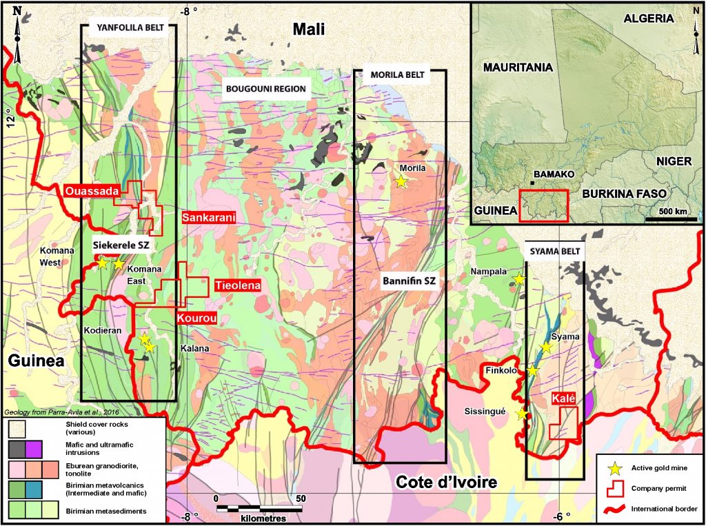
Currently and historically, the Birimian greenstone belts of the West African Craton host significant accumulations of gold as exemplified by deposits such as Obuasi (Ghana), Morila, Loulu-Gounkoto, and Syama (Mali), and Essakane, Burkina Faso. The properties in the Sikasso Project are considered prospective for orogenic gold style mineralization based on their favourable Paleoproterozoic geology and structure, including their proximity to other mineralized systems in the area.
The Ouassada, Sankarani, and Kourou permits contain a number of historic surface showings and artisanal alluvial and eluvial mines. Modern exploration, using a variety of techniques such as soil geochemistry, lithogeochemical prospecting, and airborne geophysics resulted in the identification of additional mineralization, which has subsequently been worked by artisanal miners at several localities.
Bedrock mineralization has been identified on the Ouassada and Sankarani permits, and consists of decimetre wide quartz veins with pyrite. The average gold concentration of 342 samples collected from two prospects at Ouassada was 3.11 ppm, with a large standard deviation of 6.99 ppm Au. Independent sampling of bedrock and eluvial mineralization on the Property confirmed the previous measured gold concentrations.
Interpretation of high-resolution airborne magnetic and radiometric geophysical data has identified multiple exploration targets, particularly in areas with little or no outcrops, e.g. Kalé.
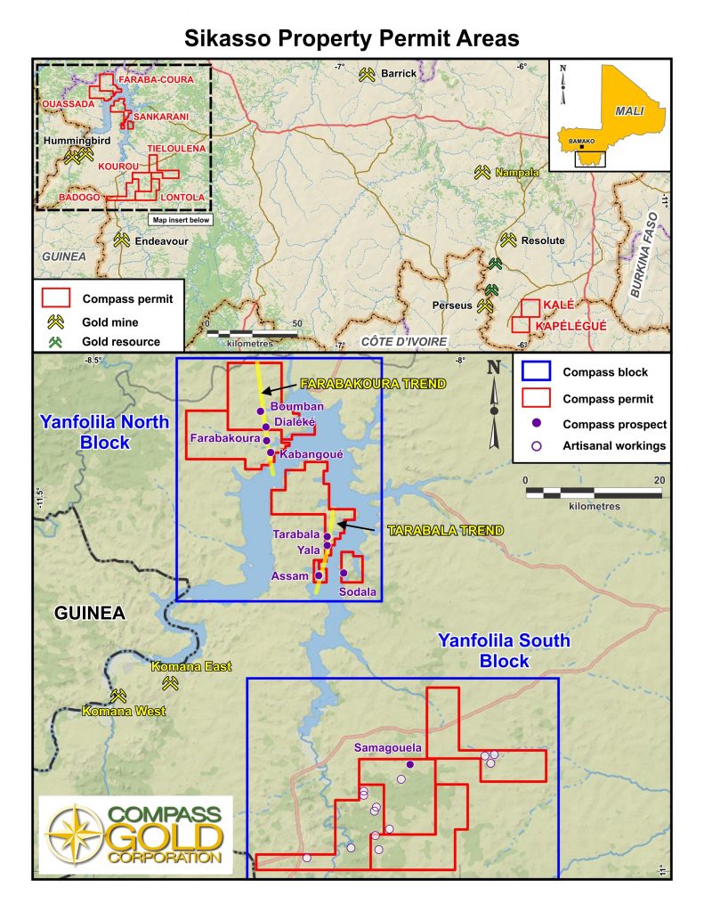
The Sikasso Property is comprised of two blocks of contiguous exploration permits (Ouassada and Sankarani, and Tieoulena and Kourou, termed the "Yanfolila Block") and an isolated permit at Kalé (Figure 4-1). The permits cover a total area of 1192.4 sq km and are situated in the Sikasso Region of the Republic of Mali. The Yanfolila Block is approximately 150 km south-southwest of the capital city of Bamako (pop. 1,809,106 in 2009), and Kalé is 340 km southeast of Bamako. The property location is illustrated in Figure 4-1.
Size and Location
The Republic of Mali comprises a total area of 1,240,192 sq. km. The country is bounded by Algeria to the north, Niger and Burkina Faso to the east, Ivory Coast and Guinea to the south, with Senegal and Mauritania to the west.
Sikasso Property Tenure Rights
The property permits were acquired in 2011 and based on continuing work expenditures are in good standing.
Accessibility
The northern two permits, Ouassada-Sankarani, of the Yanfolila Block can be accessed by the Route National 7 (RN 7) paved road from Bamako to Keleya (85 km), followed by 55 km of unpaved road to Selingue. Access within Ouassada and Sankarani is achieved using an extensive network of minor unpaved roads and drivable tracks and footpaths. Access from the north to the main part of the Sankarani permit is via a small motorized ferry at Faraba, or from the south by an unpaved secondary road from Yanfolila. The southern permits of the Yanfolila block (Tieoulena and Kourou) are accessed via the paved RN7 from Bamako to Bougouni, and the RN8 from Bougouni to Yanfolila. Within both permits access is by minor unpaved roads and drivable tracks and footpaths.
The Kalé permit can be accessed via the 375 km paved RN7 from Bamako to Sikasso, followed by a 155 km drive on unpaved roads and tracks from the Farakala turn-off (Fig. 4-1.)
Property Located in Known Gold Belts - Source: drafted by Archibald, 2017
Climate
The Sikasso Property is located on the southern edge of the Sahel, or sub-Saharan belt, and is characterized by a subtropical to hot climate and has dry and wet seasons. The rainy season extends from May to October, with an average rainfall of 800-1000 mm per annum, and a hot dry season from October to April. Mean daily temperatures range from a high of 360 degrees C in April to a low of 190 degrees C in December. Most of the region is devoted to agriculture (subsistence farming), and is planted with maize and cotton with minor areas of brush and trees most commonly located along tributaries and main drainages.
Exploration activity can be conducted year round, although extra caution must be exercised on the roads and while crossing streams in the wet season (May to October).
